A Tourist in Rome - Capitoline Insulae
The Capitoline Insulae (also known as the Insula dell'Aracoeli because of their proximity to the church of Santa Maria in Aracoeli) are the remains of an apartment building (that's what insulae means) that was discovered in 1927 when the Baroque church of Santa Rita da Cascia was destroyed to build the Victor Emmanuel Monument. It is one of the best examples of an apartment building built with brick, as opposed to the many that were wooden. The building dates from the first two decades of the 2nd century AD, about the same time as Trajan's Market. It was constructed of concrete faced with brick. Four levels of the original 5-story building are visible, some below today's ground level. Shops were on the ground floor, which is nine meters below today's pavement. The 1st and 2nd photos below look down into the excavation to shops that used to be on the ground floor and the mezzanine level above them. The 3rd photo below attempts to better show the excavated level, and the left half of the above-today's-ground structure. That left half is better shown face-on in the 4th photo below, revealing the frescoed lunette of the 12th century Church of San Biagio del Mercato. That fresco is shown better in the 5th and 6th photos below. The 5th photo below actually rests above the 1st photo below.
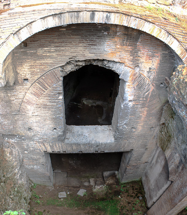
IMG_5457-IMG_5458-20141002: Shop on the ground floor of the Capitoline Insulae, and mezzanine level above it (mosaic of 2 photos)
See all
Capitoline Insulae photos.
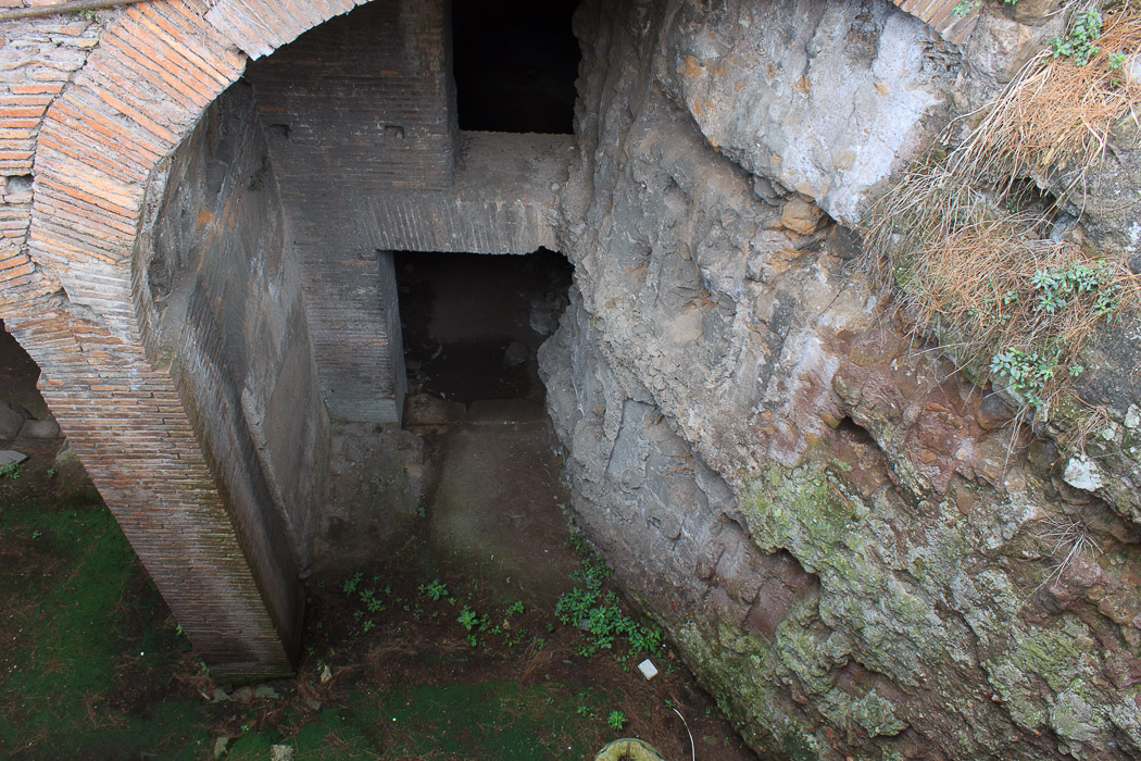
IMG_5461-20141002: Shop on the ground floor of the Capitoline Insulae, and mezzanine level above it
See all
Capitoline Insulae photos.
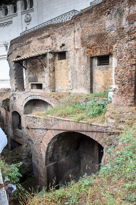
IMG_5478-20141002: The excavated lower levels of the Capitoline Insulae, and the frescoed lunette of the 12th century Church of San Biagio del Mercato above them
See all
Capitoline Insulae photos.
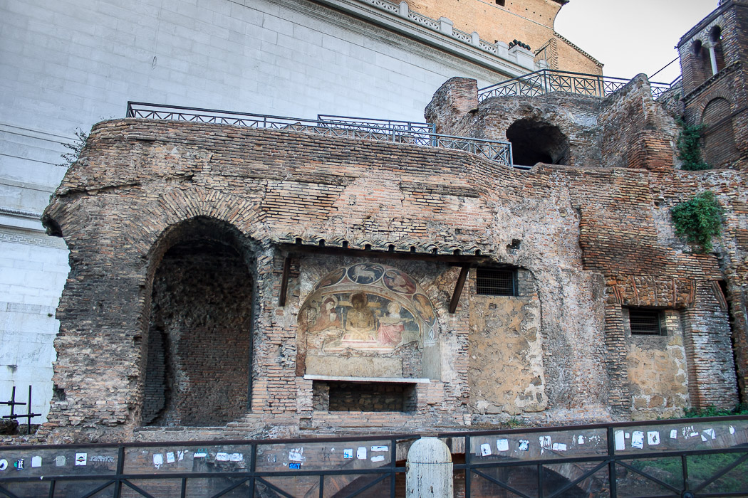
IMG_7269-20130924: The left half of the upper levels of the Capitoline Insulae, featuring the frescoed lunette of the 12th century Church of San Biagio del Mercato
See all
Capitoline Insulae photos.
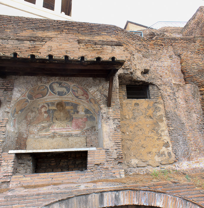
IMG_5459-IMG_5460-20141002: The frescoed lunette of the 12th century Church of San Biagio del Mercato, on the left side of the upper levels of the Capitoline Insulae
See all
Capitoline Insulae photos.
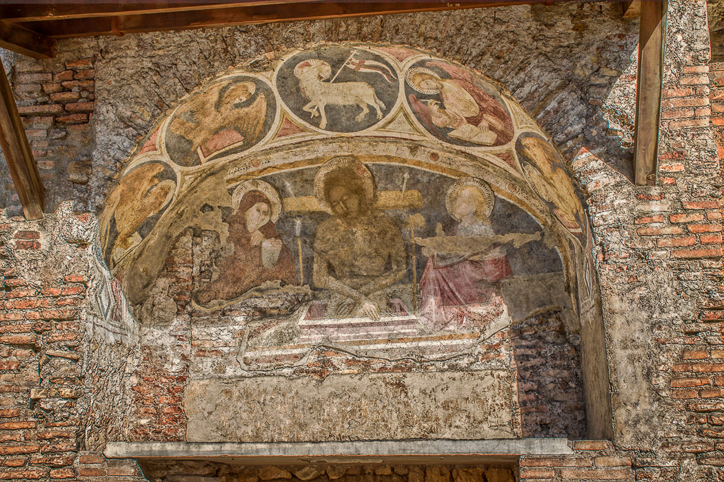
IMG_6735-IMG_6737_hdr_mode_2-20130922: The frescoed lunette of the 12th century Church of San Biagio del Mercato, on the left side of the upper levels of the Capitoline Insulae (HDR of 3 images)
See all
Capitoline Insulae photos.
The above-ground levels of the right half of the insulae are shown in the 1st and 2nd photos below. Those photos show the 3rd and 4th floor apartments (a 5th floor no longer exists). The rooms get smaller in the fourth floor, and were probably rented out to poorer people since they were less desirable due to the fact that ladders had to be used to reach them, plus the greater danger in living in them due to the frequency of collapses and fires. The building could have housed up to 350 people. In the 11th century the upper floors became part of the church of San Biagio de Mercato. The Church of Saint Rita was built on top of that church: the belfry visible today (1st and 3rd photos below) belonged to that church.